Riding the Tides: Smarter Fossil Hunts on the Jurassic Coast

Let’s plan intertidal fossil‑hunting routes along England’s Jurassic Coast by working directly from reliable tide tables. Learn to read heights and times, time spring low exposures, and link safe access points into satisfying walks. With practical anecdotes, local codes, and safety-first habits, you can transform changeable shores into purposeful explorations and come home with stories, skills, and responsibly collected finds to share with fellow coastal enthusiasts.

Reading Tide Tables Like a Coastal Navigator

Mastering a tide table unlocks more shoreline, more safely. Understand how predicted highs, lows, and heights vary by day and location, and why spring ranges reveal the broadest rock platforms. We will decode columns, abbreviations, and daily swings, converting printed predictions or app outputs into clear, confident decisions that align daylight, weather, and access with your fossil‑hunting ambitions.

Designing Routes That Flow with the Ebb

Route design merges predictions with place. Sketch an out‑and‑back along benches that dry sequentially, stepping through safe access points and pre‑identified exits. Consider underfoot texture, likely fossil yield, and crowds. Assign time boxes per segment, reserving deliberate pauses for searching promising lag deposits rather than rushes that miss ammonites hiding beneath tumbled slabs.
Out‑and‑back routes simplify timing, since returning along known ground reduces surprises as the tide turns. Point‑to‑point days can be magical but demand shuttle coordination and precise tidal margins. Check bus times, parking limits, and last‑light angles on slippery descents. Only commit if every exit remains usable under forecast swell and post‑storm debris conditions.
Study maps for headlands, groynes, outfalls, and streams spreading soft fans across the beach. These can deepen unexpectedly and block returns during the flood. Note undercliff paths, slips, and concrete ramps usable at mid‑tide. Create hard turn‑back times tied to heights, not just the clock, because different ranges flood faster than intuition suggests.
Shingle exhausts, clay grips, and algae glazes every move. Adjust pace and spacing accordingly, clustering more slowly where erosion concentrates fossils after storms. Build micro‑loops across promising seams, then rejoin the primary line. Avoid tunnel vision; schedule periodic broad scans up‑slope and down‑slope, catching belemnites and fragile impressions before fresh waves rearrange everything again.

West Dorset to Purbeck: Sites and Nuances

Different stretches reward different tactics. Lyme Regis and Black Ven deliver ammonite‑rich shales and landslip debris, while Charmouth’s foreshore invites careful scanning after winter storms. Seatown offers belemnites and plant impressions; Kimmeridge’s ledges demand algae‑aware footing. Learn access, parking, and local guidance so every chosen shoreline matches your tide‑driven plan and experience level.

Safety First: Sea, Weather, and the Living Cliffs

Fossil hunting rewards patience, not bravado. Combine tide predictions with reliable marine forecasts, watching swell period, wind direction, and pressure. Rain saturates cliffs, priming sudden falls; sun blinds late returns. Helmets near active slips, eye protection when levering nodules, and communication plans with shore contacts create resilience that keeps adventures memorable for the right reasons.

Responsible Collecting and Local Guidance

Ethical choices protect this coastline’s scientific story. Follow the West Dorset Fossil Collecting Code, avoid hammering bedrock, and report significant vertebrate finds. Join guided walks from Charmouth Heritage Coast Centre or Lyme Regis Museum. Respect SSSI protections, private land boundaries, and fellow visitors, building a culture of curiosity, kindness, and shared discovery along every shore.

Field Kit, Data, and Trip Logistics

Thoughtful preparation multiplies results. Pack layered clothing, waterproofs, gloves, and eye protection. Add a first‑aid kit, whistle, power bank, OS maps, and tide‑table screenshots. Mark access, parking, and toilets. Bring hot drinks, high‑calorie snacks, specimen bags, and labels. A calm post‑hunt routine protects finds and creates space to share insights with new friends.

Navigation and Data Redundancy

Phones fail; paper shines when batteries fade. Print route notes, tide times, and emergency contacts. Preload offline maps and mark exits as starred waypoints. Carry a small compass. If fog rolls in or heavy rain blocks screens, these backups transform confusion into orderly, confident steps toward safe, timely returns and warm, relieved smiles.

Comfort, Warmth, and Food

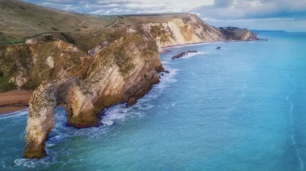
Cold hands miss detail, and hunger ends focus. Thermos flasks, windproof layers, and dry socks extend patience on long, exposed traverses. Schedule snack breaks away from cliff bases, watch the waterline, and share warm drinks with companions. Comfort builds goodwill, and goodwill builds the calm attention required to notice delicate, easily overlooked treasure.

Recording and Sharing Discoveries

Photograph finds with a scale, log tide height and time, and jot a brief site sketch. Later, share a selection with local groups or museums, or tag us with your day’s highlights. Subscribing for future route guides helps you build seasonal insight, while your comments and questions inspire fresh, community‑tested improvements for everyone.

Piramirapexiveltozentonilo
Privacy Overview

This website uses cookies so that we can provide you with the best user experience possible. Cookie information is stored in your browser and performs functions such as recognising you when you return to our website and helping our team to understand which sections of the website you find most interesting and useful.